
01 / ROOF COVERINGS
Tiles & slates
Visible slipped, broken or missing coverings, weathering and areas that may warrant closer repair access.
Detailed visual inspections of roofs, chimney stacks and other difficult to access high-level building features.
Roof coverings, chimneys and gutters are often difficult to assess fully from the ground. Problems may not be apparent until water ingress or other damage develops.
Chant Surveys uses drone photography where suitable, to obtain close visual views of accessible high-level building features. These images help us identify visible defects and explain the likely maintenance or whether further investigation is required.
You'll receive straightforward advice supported by clear photographs.
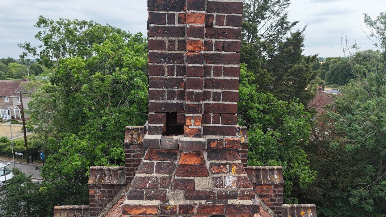
Subject to visibility, access, flight restrictions and weather conditions, a drone can help inspect:
Visible slipped, broken or missing coverings, weathering and areas that may warrant closer repair access.
Apparent defects in ridge or hip finishes, mortar bedding and exposed roof edges.
Visible weathering to pointing, chimney pots, flaunching, masonry and adjacent flashings.
Visible condition of roof junctions, leadwork, abutments and other susceptible areas.
Visible blockages, vegetation, detached components and high-level water drainage arrangements.
Accessible roof surfaces, upstands, perimeter details and other features that are hard to see from below.
Drone surveys can provide closer views of high-level defects and hard to reach roof areas, helping to inform maintenance decisions and further investigation.
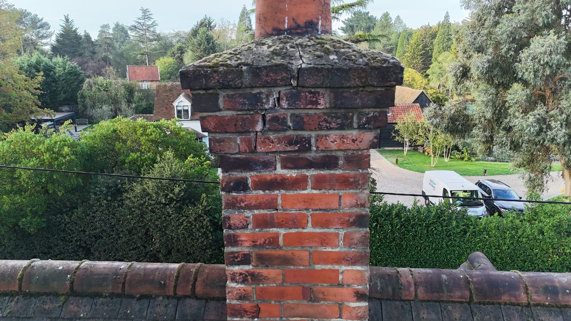
Close-up views can help identify visible cracking, open joints and other signs of weathering at chimney stacks and masonry details.
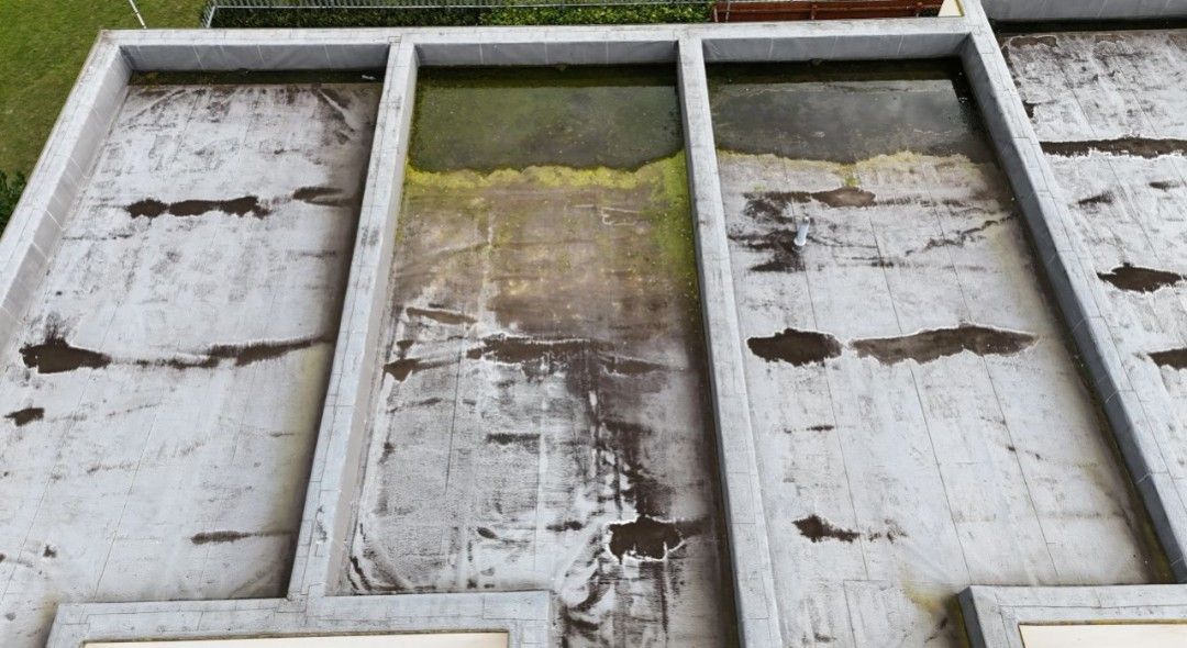
Flat roofs can often be viewed more effectively from above, highlighting ponding, staining, vegetation growth and surface deterioration.
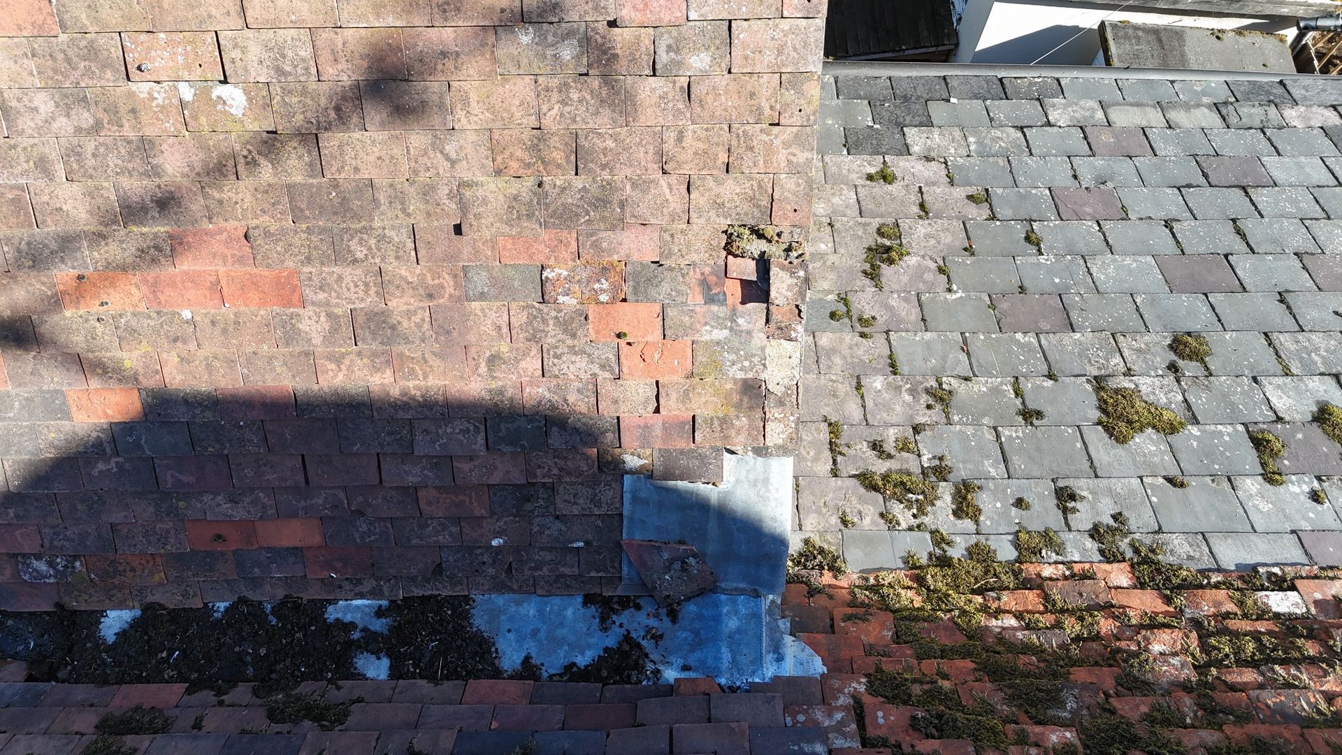
Drone images can reveal slipped or damaged coverings, moss growth and defects around abutments and junctions that may not be obvious from the ground.
From inspection planning to a clear assessment of visible defects.
We'll ask about your property, concerns and the areas you would like assessed.
Where conditions and flight rules allow, we capture suitable high-resolution photographs of relevant areas.
We'll explain visible defects, their significance and recommended maintenance or further checks in a PDF report.
The value of a drone survey is not simply obtaining aerial images — it's understanding what the photographs show and what action, if any, is appropriate.
Experienced residential surveying, combining building knowledge with modern drone technology to assess high-level building defects.
Chant Surveys holds a Civil Aviation Authority (CAA) Operator and flyer ID. Inspections are conducted in accordance with applicable aviation regulations and safety requirements.
Clear photographic reports explaining visible defects and recommending appropriate next steps, without selling remedial works.
No. It is a visual inspection from available external viewpoints. Hidden layers, underlays, structural timbers and areas obscured by roof details cannot be confirmed from aerial photographs alone.
Usually these can be included where the drone can obtain suitable views safely and legally. Please explain any specific concerns when requesting a quote.
No. Drone surveys capture images whilst the aircraft is airborne, without placing it on the roof.
Yes. At Chant Surveys, drones and telescopic camera poles are used where appropriate to support our RICS Level 3 Building Surveys, providing closer views of roof coverings, chimney stacks and other difficult to access areas. Dedicated drone surveys are also available as a standalone service, subject to suitable conditions and an agreed inspection scope.
Flights may need to be rescheduled or replaced by other safe visual inspection methods. Wind, rain, visibility and airspace or site restrictions can affect whether a drone is appropriate.
Request a drone survey and get independent observations with clear, practical next steps.


